Wednesday, August 31, 2011

Tropical Troubles & A Cold Front


Tropical Development in the Gulf Mexico continues to look more likely heading into the Labor Day weekend. Most computer models are showing some degree of development of the tropical wave now moving into the Eastern Gulf. The details of development vary greatly as to where the tropical system will take shape and how strong it may get. The general consensus is that a tropical cyclone will be somewhere in the Northwest Gulf by the weekend. Initially, this system will be very slow moving which will bring heavy rains into the Gulf Coast beginning Friday and into the weekend. Depending on how far North the system makes it, some bands of rain may begin to enter Southern Arkansas by Saturday morning. This is what is indicated by one of tropical forecast models.


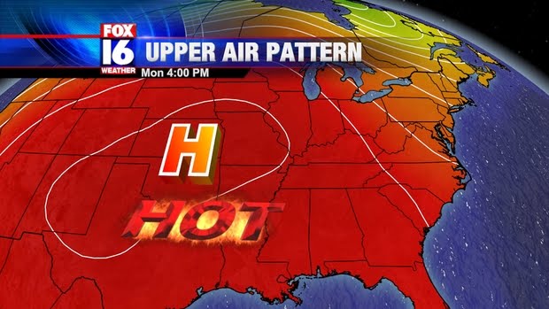
The system will move very little over the weekend, meandering in The Gulf for a couple of days with very weak steering currents. By Labor Day, a fairly strong cold front will push through Arkansas toward the Gulf. This will bring much welcomed relief from the the Summer heat for Arkansas, and it could mean a couple of things for the Gulf low. One possibility is it will get picked up by the front and begin to accelerate toward the Northeast along the front, which is the first scenario depicted below


Alternatively, the front may not pick it up, leaving it in the Gulf. In this scenario, the system would likely drift West or Southwest around a large high building in behind the front. This could actually be a good scenario for Texas, since they desperately need rainfall.


Bottom line here, its extremely difficult to predict the future of a storm that has not yet developed. Heavy rain along the North Central Gulf Coast is very likely with either scenario, but beyond that the details are still up in the air. Everyone along the Gulf Coast from Florida to Texas needs to pay close attention this weekend.


Sunday, August 28, 2011

On the Eve of Katrina

All eyes have been focused on Irene over the last few days, which hit North Carolina and New Jersey as a category 1 hurricane followed by landfall as a tropical storm in New York City early Sunday. As I've watched the coverage of reporters standing in the wind showing flooded parking lots and water in basements, I'm reminded of the scenario unfolding on this day 6 years ago. Katrina was an extremely large category 5 hurricane, the 3rd most intense ever observed anywhere in the Atlantic Basin and it was heading straight for the Gulf Coast within a matter of hours. I was a meteorologist at WVUE in New Orleans at the time, in continuous coverage as the storm closed in. Our weather and news teams were doing everything we could to communicate the severity of the situation and encourage people to get out of the evacuation zones as time was quickly running out. Below is the statement released by the National Weather Service that Sunday afternoon. Although the statement put a lot of emphasis on wind damage, the record storm surge and subsequent levee failures led to essentially the same result.

URGENT - WEATHER MESSAGE
NATIONAL WEATHER SERVICE NEW ORLEANS LA
413 PM CDT SUN AUG 28 2005

...EXTREMELY DANGEROUS HURRICANE KATRINA CONTINUES TO APPROACH THE
MISSISSIPPI RIVER DELTA...
...DEVASTATING DAMAGE EXPECTED...

MOST OF THE AREA WILL BE UNINHABITABLE FOR WEEKS...PERHAPS LONGER. AT
LEAST ONE HALF OF WELL CONSTRUCTED HOMES WILL HAVE ROOF AND WALL
FAILURE. ALL GABLED ROOFS WILL FAIL...LEAVING THOSE HOMES SEVERELY
DAMAGED OR DESTROYED.

THE MAJORITY OF INDUSTRIAL BUILDINGS WILL BECOME NON FUNCTIONAL. PARTIAL
TO COMPLETE WALL AND ROOF FAILURE IS EXPECTED. ALL WOOD FRAMED LOW
RISING APARTMENT BUILDINGS WILL BE DESTROYED. CONCRETE BLOCK LOW RISE
APARTMENTS WILL SUSTAIN MAJOR DAMAGE...INCLUDING SOME WALL AND ROOF
FAILURE.

HIGH RISE OFFICE AND APARTMENT BUILDINGS WILL SWAY DANGEROUSLY...A FEW
TO THE POINT OF TOTAL COLLAPSE. ALL WINDOWS WILL BLOW OUT.

AIRBORNE DEBRIS WILL BE WIDESPREAD...AND MAY INCLUDE HEAVY ITEMS SUCH AS
HOUSEHOLD APPLIANCES AND EVEN LIGHT VEHICLES. SPORT UTILITY VEHICLES AND
LIGHT TRUCKS WILL BE MOVED. THE BLOWN DEBRIS WILL CREATE ADDITIONAL
DESTRUCTION. PERSONS...PETS...AND LIVESTOCK EXPOSED TO THE WINDS WILL
FACE CERTAIN DEATH IF STRUCK.

POWER OUTAGES WILL LAST FOR WEEKS...AS MOST POWER POLES WILL BE DOWN AND
TRANSFORMERS DESTROYED.
WATER SHORTAGES WILL MAKE HUMAN SUFFERING
INCREDIBLE BY MODERN STANDARDS
.

THE VAST MAJORITY OF NATIVE TREES WILL BE SNAPPED OR UPROOTED. ONLY THE
HEARTIEST WILL REMAIN STANDING...BUT BE TOTALLY DEFOLIATED. FEW CROPS
WILL REMAIN. LIVESTOCK LEFT EXPOSED TO THE WINDS WILL BE KILLED

Saturday, August 27, 2011

Eastern Coast Hurricanes

As Hurricane Irene continues to batter the east coast with heavy rain and gusty winds, I decided to spend some time looking back at the history books on tropical systems that hit the eastern coast.


The last time a hurricane affected New York/New England region was back in 1991 when Hurricane Bob rushed through the eastern side of the U.S.  Very similar to Irene, Bob tracked along the east coast as a Category 3 storm before dropping intensity across land.  By the way, Bob was the costliest hurricanes in New England's history.

At this stage of the game Irene doesn't appear to have the same strength as Bob, but it will sure leave a trail of damage behind.


Of course nobody can forget the 1938 Hurricane that was the absolute worst for the region.  According the record books, there was a 21 foot storm surge that struck Long Island.  Along with the high surge, there were winds reaching 130 mph.  Unlike Irene, the hurricane was not forecasted to hit the region leaving 800 deaths across Long Island, Connecticut, Rhode Island and Massachuetts.

Let it be known that Irene will be memorible for its track then its intensity.  It doesn't appear on the scale of Hurricane Bob or the 1938 Hurricane but since it will impact millions it will be known for years to come.

---------------------------------------------------------------------------------------------------------

Friday, August 26, 2011

Irene Heads for East Coast


The outer rain bands of Irene are already beginning to move into The Carolina Coast. Despite a pressure drop overnight, Irene has weakened a bit overnight, with winds down to 105 MPH as of the 11AM EDT advisory making it a category 2 storm. Irene has also completed the turn, with the average motion now toward the North to NNE. Typically, a hurricane will peak in strength before or near the time of recurvature, so significant restrengthening is not particularly likely before it reaches North Carolina. After that time Irene will interact with land and the Center will move over cooler water which will cause weakening as it moves up the Mid-Atlantic Coast toward the NE.
Here's the question: Does Irene actually make landfall as a hurricane?

Forecast models have actually shifted a bit East in the near term, which would take Irene very close to The Outer Banks. The graphic below shows the 11 AM advisory forecast cone compared with the latest models.


Most of the models are now on the right side of the forecast in the 12-36 hour range. It is quite possible that the eye of Irene skirts just offshore from the Outer Banks, although the majority of model solutions still show landfall. Irene will approach The Outer Banks by Saturday Morning likely as a category 2. Irene will accelerate North-Northeastward Saturday afternoon. The question still is whether ir not Irene takes more of an inland track or stays offshore.


An inland track would cause faster weakening than if Irene stays offshore. The water offshore from NJ and Long Island is around 24-25 degrees Celsius (75-77 F) which is still cold enough that Irene would still weaken somewhat before moving into New England if it takes the offshore track. Even if Irene should stay far enough East that it misses NC and the mid-Atlantic coast, it is unlikely to avoid hitting New England. It is quite possible, however, that Irene weakens to a strong tropical storm by that time.

Thursday, August 25, 2011

Irene Taking Aim At East Coast


Hurricane Irene is about to pass East of Nassau Bahamas. Nassau recently reported a wind gust of 101 MPH at the Templeton Global Advisors Limited Weatherbug station
While tropical storm force winds will stay offshore from Florida, Irene will turn its attention to North Carolina over the weekend. The latest forecast track from the National Hurricane Center has shifted somewhat West, which puts Eastern NC, including The Outer Banks, at risk for landfall.


The forecast in the longer range remains tricky, as just a small difference in the exact track will make a huge difference of what happens along the Mid-Atlantic into New England.


A track on the left side of the cone would result in Irene staying over land, causing considerable weakening as it heads toward the Northeast. In this case, Irene would likely weaken to a tropical storm before approaching D.C. and would continue to weaken as it pushed toward New York. A track on the ride side of the cone would result in Irene staying offshore and not making landfall until reaching Maine or Maritime Canada. In that case, Irene would stay stronger, but weaken over cold waters before reaching land. The in between solution pushes Irene almost right up the coast. Although Irene would weaken somewhat, it would still remain a hurricane as it approaches New Jersey and NY, likely as a category 1. This is the worst possible outcome since it would bring hurricane or strong tropical force winds to almost the entire Mid-Atlantic and N.E. Coast.


Wednesday, August 24, 2011

Wake Up Call


Talk about a surprise...well...not really.  Yesterday, it appeared that our rain chances would be pretty slim today. To be honest, all the computer models were hinting at another steamy, hot Wednesday.  Not a wet, soggy stormy morning.

                                              (Model showing upper air disturbance moving in to Arkansas)

What happened?

Well, late last night I tweeted that a new upper level disturbance was emerging in the flow and that it would bring up our rain chances the next morning.  Sure enough the disturbance developed a thunderstorm complex and sent it our way early today.  At this point, our ground is soaked with a good half inch of rain.

How come you weren't able tell us about it on Tuesday afternoon?  Well, these features are extremely difficult to track well out past 24 hours...Plus every model out there wasn't even suggesting this kind of setup.

Now that I have that out of the way... 

REST OF TODAY:  A couple left over showers will invade from the north.  Otherwise we'll be drying out in the afternoon and see the sky reveal a little more sunshine.  Temperatures will struggle to get back to 90 degrees.  Most of the time they'll stay in the 70's and 80's so you'll get to enjoy a nice break from the summer heat.

TOMORROW:  Don't put away those umbrellas.  A cold front will be sliding in here on Thursday and this give us another decent shot at widely scattered thunderstorms.  The best chance of running into these storms will be during the late morning and early afternoon hours.  Otherwise temperatures will climb back to the 90's.

FRIDAY-WEEKEND:  Once the cold front slips past our state, it will be less humid. (YES!!)  Temperatures will stumble to the upper 60's overnight and rise to near 90 degrees in the afternoon with lots of sunshine.


HURRICANE IRENE:  If you haven't heard it yet, Hurricane Irene has strengthen to a Category 3 storm with winds reaching 115mph this morning.  The eyewall is very defined on satellite and is tracking northwest through the Bahamas.  As you have read on this blog, the storm track continues to turn more to the right.

The eastern coast of North Carolina will be under the gun and will likely receive a glancing blow from the center of the storm by Saturday.  As it tracks farther northward toward New Jersey and New York, it will loose it strength and will be Category 2 or Category 1 hurricane.

--------------------------------------------------------------------------------------------------------------

Stormy Surprise

A weak upper disturbance managed to trigger a large complex of storms which dropped Southward across Central AR this morning. There has not been much in the way of severe weather with this system, although some wind damage was reported around Cabot in Lonoke County. The storm complex will continue to drop through AR with the main area of storms pushing into South/SE Arkansas by later this morning. Lingering rain and thunder will continue across Central AR through about mid-day as the complex weakens. The morning clouds and rain will keep the temperatures down this afternoon with highs only reaching the upper 80s to lower 90s instead of upper 90s to near 100. More showers and storms are likely on Thursday and a cold front pushes into the State.

Tuesday, August 23, 2011

Irene - The Turn is Coming


Hurricane Irene is getting stronger tonight and is about to make a turn more toward the Northwest on Wednesday. By Thursday, Irene is going to take a more Northerly direction as it begins to move through a pronounced weakness in the sub-tropical ridge as shown by the above graphic. The big question going forward is whether or not Irene makes landfall, or skirts the coast offshore. What ultimately happens will be determined by the strength of the Atlantic High.


Above is the forecast steering flow for Sunday. If the high is strong enough Irene will be forced closer to the coast or onshore. A slightly weaker high or if the high is positioned a little farther east, would mean Irene would stay offshore, as indicated by some of the model guidance.


The above graphic shows the 11PM EDT forecast cone compared with with the Tuesday evening model runs. Note that models are still on the right side of the cone for the day 4-5 time frame. NC outer banks and New England need to pay close attention.


Irene - The Shift Continues


The shaded area shows the new 11am advisory compared to previous forecast track from 5am. Once again, the track is shifted East, with Florida now entirely out of the cone. Irene is a large system though, and tropical storm force winds will likely brush the FL coast, especially if Irene moves on the left side of the cone. It is more likely, however that Irene will move somewhat right/East of the track. Model guidance has also shifted East and is more tightly clustered than in previous runs indicating higher confidence. Some of the guidance is now even indicating that the center of Irene may not actually make landfall in the US, although Irene's large size would still mean heavy rains, strong winds, and beach erosion for the Mid-Atlantic into New England even if there is no actual landfall.

Monday, August 22, 2011

Irene - A clearer picture


Irene became a hurricane late last night as it moved across Puerto Rico. As of 10 CDT this morning, winds had increased to 80 MPH. Yesterday, we discussed how the land areas of of Hispanola and Cuba could have a significant weakening effect on Irene, however, it now appears the center will likely remain offshore from the Dominican Republic and Cuba. Below is the 10AM CDT NHC forecast track with cone of uncertainty for the next couple of days.


This means a couple of things for the future of Irene. First of all, Irene will get stronger as it remains over warm water. Irene will continue to intensify as it remains primarily over water, now forecast to reach category 3 intensity by the time it reaches The Bahamas later this week. This stronger, more Northerly solution in the short term has significant consequence in the long term. The stronger system will be more influenced by the weakness in the sub-tropical ridge near the East Coast, allowing for a more pronounced turn to the North. The forecast track has been significantly shifted to the East this morning, with a greater threat now for The Carolinas.


The shaded area in the graphic above shows the newer 11am forecast cone compared to the older 5am forecast which is outlined in yellow. The East Coast of Florida is still in the cone, but the trend continues to be for Irene to move along the Northern and Eastern side of the forecast. Computer models continue to shift more North and East, indicating Irene may be a threat to a large portion of the east coast. Also note that the models are still somewhat more concentrated on the right/East side of the 5 day forecast cone.


Sunday, August 21, 2011

Irene - First real hurricane threat of the season


As of Sunday afternoon, Tropical Storm Irene is located in the NE Caribbean, taking aim on Puerto Rico. The circulation is quite large, but so far intensification has been modest as it has been struggling somewhat with some mid-level dry air. The intensity forecast for Irene is going to prove very problematic as it complicated by several factors, but the main determining factor for Irene's intensity is interaction with land. The small NE Caribbean islands are not large enough to have a significant impact on Irene, but by tonight Irene will approach the larger island of Puerto Rico, and by Monday Irene will move very close to or directly over Hispanola. Not only is Hispanola much larger than the other islands, but much higher too. The highest elevations of the Dominican Republic, which comprises the Eastern 2/3rd of the island, exceed 10,000 feet. Higher, rougher terrain more effectively disrupts the circulation of a tropical cyclone. If Irene moves right over this mountainous area it will likely weaken considerably by then time it moves back over water. Then Irene must deal with Western Cuba, which is also quite mountainous. The graphic below shows the forecast cone overlayed on top of Cuba and Hispanola. Given the forecast error, Irene may or may not spend a considerable amount of time over land


Should Irene move along either Southern or Northern edge of the forecast cone, the weakening effect would be lessened, allowing for Irene to potentially become a formidable hurricane. A track straight down the center could disrupt the circulation to the point where Irene may struggle just to hold together. Such an uncertain intensity forecast makes the track forecast less certain too, as the movement of a tropical system system can be significantly affected by intensity. Everyone from the Eastern Gulf of Mexico to The Carolinas needs to pay attention to what happens over the next couple of days as it moves through The Caribbean.


Tuesday, August 16, 2011

Watching the Tropics Closely


I am growing a little concern about what is taking place in the long range models.  In the last several days, the models have depicted a large hurricane forming in the Atlantic Ocean and blasting the southeast coast of the U.S. by late August.  Normally, I would disregard these as false anomolies but we have consistantly seen the same kind of results from the same models.


                                            (GFS model showing major hurricane around August 28th)


                                          (Another run of GFS model showing the hurricane hitting on August 30th)


                                         (European Model showing a strong tropical system east of Florida by Aug. 25)
So what can we take from all of this?  Not much for right now.  Usually models are not reliable this far out in advance, so at this point, we're going to keeping a close eye on the tropics and see if indeed these long range models are picking up on something.  Until then relax and keep tuning to FOX 16 for the latest developments.

Lets get back to our weather in Arkansas shall we...

TOMORROW: A weak (I mean weak) frontal boundary is going to approach from the north on Wednesday.  According to most high resolution models we'll see the front sag in Northern Arkansas.  This will be the main focus point for small showers and thunderstorms to form off of during the afternoon hours.  Since our rain coverage will not be high tomorrow and our winds will start coming out of the south/southwest, our temperatures are going to rise to the mid 90's.  In southwest Arkansas I wouldn't be surprised to see a couple thermometers flirt with 100 degrees.

THURSDAY-FRIDAY: The frontal boundary washes out but a few upper level disturbance will slide through portions of Arkansas.  This situation will leave the door open for a few chances at brief rain showers and thunderstorms.  Besides that we'll continue to stay pretty hot in the mid-upper 90's.

WEEKEND:  Rain chances only exist for the northern part of the state.  Otherwise it will be hot outside with high's in the upper 90's.

That's it for now.  Keep checking on the blog for the latest developments in the tropics.

-------------------------------------------------------------------------------------------------------------

Saturday, August 13, 2011

Cold Front Bears Down on Arkansas


A new video update is up and running.  It quickly goes over how the rest of the evening will pan out and what is on the horizon for Sunday.  Check it out.


-------------------------------------------------------------------------------------------------------------

Thursday, August 11, 2011

Rains Bring Drought Relief


Another wet morning across most of Central Arkansas is bringing some much needed relief from the dry conditions. The US Drought Monitor released its weekly update this morning, with much of Arkansas in severe to extreme drought.


The update is based on information through Tuesday, so the rainfall from yesterday and today is not taken into account. So far this month, Little Rock has received 2.63" of rain, almost the entire average for the month of August. The rain has also reduced fire danger, and as a result many Arkansas Counties, including Pulaski, have lifted their burn bans. The Counties in red are still under burn bans as of Thursday morning.


Several more rounds of rain and some storms are likely through Saturday, which will further erode the severity of the drought conditions. A cold front will push through late Saturday, bringing back drier weather for the early part of next week. The good news is the front will also bring in some slightly cooler and less humid air.

Wednesday, August 10, 2011

Rainier Days


A much rainier pattern has developed this week with a stalled front across the State and a series of disturbances moving through. One came out of Oklahoma this morning with pocket of heavy rains and strong winds moving across mainly Northern parts of the metro area. Wind damage was reported around Conway and Sherwood as the storms rolled through. Most of this activity has pushed East and out of Arkansas, however, another, area of rain and some storms can be seen on the Radar loop moving into NW Arkansas. Most of Central Arkansas will have dry conditions through the early afternoon, with a renewed threat of some rain and a few storms later in the afternoon. Although a few storms may become strong, coverage will be limited due a lack of strong daytime heating because of widespread cloud cover. Here are a couple of pictures of the storms rolling in from this morning.

Storm clouds approaching Sherwood this morning.

Ominous looking clouds over Downtown Little Rock


Tuesday, August 9, 2011

The Extreme Heat is Gone!


Hallelujah!  The strong upper level ridge is finally gone!  After weeks of intense heat and sizzling sunshine, we are being rewarded with a cooler weather pattern this week.  We've already seen a good amount of cloud cover and rainfall in recent days.  In fact, a weak cold front actually slipped past Little Rock this afternoon and has kept temperatures down in the low 90's today...the low 90's!  It hasn't been this nice in the afternoon since mid July.

I've got some more great news to share with you...but before I get to to the really good stuff let's talk about the upcoming work week...

TOMORROW:  I'm going to be honest here...tomorrow is pretty hard to forecast.  Jeff and I have been discussing it for a while now.  On Wednesday, there will be a weak cold front drapped across Central Arkansas.  With enough daytime heating that should help a few thunderstorms develop during the day.  That's what were thinking at this time, but several high resolution models are hinting at a cluster of thunderstorms diving in from Kansas and Southern Missouri and hitting us by the mid-morning hours. 

The biggest question is which one of these solutions is going to pan out.  If the cluster of thunderstorms come during the late morning then we'll barely get to the upper 80's around here.  If the other situation pans out then we'll easily get to the mid 90's.  Jeff and I are going to stick with the latter for now. 


                                                           (model showing rain late tomorrow morning)

REST OF THE WORK WEEK: A weak frontal boundary will remain overhead and keep our rain chances alive this week.  Best opporunity for rain and storms will obviously be in the afternoon.  Aside from the scattered showers and storms, temperatures will be a mixed bag of 80's and 90's depending upon where you live.

WEEKEND:  Remember the great news I promised?  Well, here it is.  A cold front will venture down here late on Saturday.  And this isit your ordinary summer cold front that drops our temperatures a couple degrees.  Oh no, this puppy is a full blown cold front.  The front could be so strong that we may struggle to get out of the upper 80's by next week.  Besides bringing down our temperatures, this front will also bring down our humidity for a change.


So there you have it.  Keep those umbrellas handy and get those jeans ready to go.

-------------------------------------------------------------------------------------------------------------

Wednesday, August 3, 2011

Hottest Day Ever Recorded


Today will go down in the record books as the hottest day ever in Little Rock's history.  Ever since the records have been kept in 1877, the hottest temperature was recorded on July 31, 1986 with a staggering 112 degrees being the benchmark.  Not only did we tie the record at one point, but we beat the record by an amazing two degrees and ended up at 114 degrees for the day.

What happened?  Well, we knew today was going to be hotter than yesterday but not by this margin.  There wasn't a single meteorologist out there who thought we would be hitting 114.  Having said that, the reason for the intense heat to strike Central Arkansas was a culmination of several ingrediants coming together at the right moment. 


First and foremost, a strong area of high pressure was and is directly overhead.  This high pressure coming in around 20,000 feet helps to develop suttle sinking motion in the atmosphere.  Basic meteorology tells us that when you sink atmospheric air it heats up incredibly fast (especially in the summer time) and in our case it soared.  The fact that we had this heat machine aloft was the main reason we got to the triple digits.  Another factor that played into all this mess was the fact that we saw plenty of sunshine today.  Early this morning we had to fight through some cloud cover to see the sun.  Yet, as time rolled along to the noon hour the clouds quickly dispersed and left us sizzling in the heat.  The incredibly dry soil was another factor that played into it feeling like a oven outside.  Last but not least, our surface moisture wasn't as high today.  Since we had less moisture to deal with, temperatures were allowed to sky rocket past 110 degrees.

So many of you are wondering how long will this brutal heat wave remain in Arkansas?  After throughly looking at several computer models and the various sorts of weather data I can honestly say it won't change soon.  The upper level high will stay with us the rest of the work week.  It won't move westward until the latter half of the weekend.  That means temperatures will be consistantly above 100 at least until we get to next week.


-------------------------------------------------------------------------------------------------------------

Monday, August 1, 2011

2011 Heat Wave

It has already been an extremely hot Summer for Arkansas, but the hottest temperatures of the Season are on the way for this week. All ingredients are coming together for a long stretch of high temperatures WELL above the 100 degree mark for all of Central AR. The first component to the hot weather is a large ridge of high pressure that is currently centered just West of Arkansas. This high creates sinking air resulting in hot temperatures and little if any afternoon showers. This high will be centered almost directly over Arkansas by the middle of this week


The second main factor is how dry it has been in July. Many areas have had only a fraction of normal rainfall for July. Little Rock experienced its 3rd driest July on record with only .24" for the Month. This has led to drought conditions across most of the State


The dry ground heats up faster than ground that has more moisture, allowing for hotter afternoon temperatures.

Although temperatures will be over 100 today and tomorrow, highs should fall short of the records. By Wednesday, however, record highs will be threatened across much of the State.


Interestingly enough, the records for Tuesday and Wednesday were established from last year's heat wave, in which temperatures topped out at a blistering 107. Not much in the way of relief is in sight through the end of the week, although the upper high will slide a bit further to the West, allowing temperatures to come down at least slightly.