Monday, January 31, 2011

Monster Snow Storm about to commence


Tonight's computer models continue to indicate a snow event that will bury parts of the Central Plains into the Midwest. The top image is a computer projection of snow depth by early Wednesday morning. The bottom is our FOX16 high resolution RPM total snowfall projection through Tuesday night. Both show a stripe of 1 to 2 feet of snow from Central Oklahoma and into Missouri with some even higher amounts possible. This storm will essentially shut down some cities by Tuesday afternoon including places like Oklahoma City, Tulsa, Springfield, MO, St. Louis and eventually Chicago. The heavy band of snow will cut through Northwest Arkansas, with over a foot around the Fayetteville area. North Central Arkansas, around the Harrison area, precipitation will begin as rain but quickly change to freezing rain Tuesday morning and then to snow by midday. Snow and ice accumulations will drop of rapidly going South and East. Very little or no snow accumulation is expected East of Russellville and South of Clinton. A slight shift in the track of the low pressure system will have a significant influence on snowfall amounts.

Tuesday Snowfall Forecast


This one is going to be a rain maker for Central Arkansas, but Northwest Arkansas into Oklahoma and Missouri is going to get hammered by snow. Up to a foot of snow is likely around the Fayetteville area with even heavier amounts into Northeast Oklahoma where up to 20" is expected. Travel is not recommended tomorrow, especially along I-40 West of Ft. Smith which may have to be shut down for a period of time due to heavy snow and poor visibility. Across North Central Arkansas from North and West of Russellville to North of Clinton, rain will change to freezing rain and then over to snow. The freezing rain won't last long, keeping ice accumulations under a quarter of an inch, which isn't enough to bring down many trees and power lines. Snowfall amounts will be about 1 to 3 inches with heavier amounts North and West. Thunderstorms will be the main concern South of Little Rock, where some storms may briefly become severe along a strong cold front. The front will usher in much colder air Tuesday night into Wednesday. Most roads will have a chance to dry off before the temperature drops below freezing Tuesday night, so icy road conditions will only be very isolated in Central Arkansas going into Wednesday morning.

Overall, this storm system will be beneficial to Central Arkansas because we need the rain after a very dry January. Many areas received less than half the normal rainfall, leading to dry soil conditions and high grass fire danger.

Winter Storm Getting Closer


Another strong winter storm is ready to blow through the mid-section of the U.S. tomorrow. In the video I describe how it will impact Arkansas. I hope you enjoy.

Sunday, January 30, 2011

The Future Won't Be So Beautiful

I apologize for the lack of video updates but the software is malfunctioning again.  I should have it resolved once and for all tomorrow.  In the meantime here is a thorough update to what is going on across the state.


REST OF TODAY:  Obviously if you can't tell, it is not as bright or as warm as yesterday.  I know, I know...I wish it could be nice again but let's be real...It's still Janurary and we got spoiled on Saturday. Nevertheless, a weak cold front is slowly diving in from the north and it is now just knocking on Little Rock's doorstep.  The fact that the front arrived so late today and we managed to break out into sunshine this morning, created an atmosphere where temperatures surge to the upper 60's.  Of course, all that is changing with the cooler air invading from the north and cloud cover quickly rapping up.  Not only is the cold front creating a cooler feeling for our friends to the north but it is also spawning a few isolated storms especially in central Saline County.  These storms are the not the fastest and could lead to localized flooding so be careful if you live north of Benton.

Through the evening and overnight hours we'll keep the cloud cover in tact while our winds fetch in cooler air.  An isolated shower or storm can't be ruled out especially if you live south of Little Rock.  At this point it looks like a safe bet that temperatures will slowly back down to the 40's after midnight.

MONDAY:  Due to the northeast/east wind and a good low cloud deck overhead we'll struggle to get back to the 50's tomorrow.  You won't have to worry about heavy rain as there appears to be little if any lift in the atmosphere on this day.  Although, we may have a few spots in Arkansas that could receive some spotty drizzle at times.


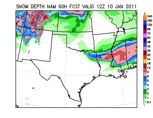
TUESDAY:  Mother Nature has a nasty storm system developing in our backyard...Literally.  A deep surface low will develop in Texas and mature over our great state on this day.  What does that mean for us?  Well for one thing plan on a lot of heavy rain.  So get those umbrellas ready.  Short term models are spitting out 1-2" of the wet stuff on Tuesday.  In addition to the damp scenery we have the potential for snow in the northwest tip of the state.  Current data suggests anywhere from 3-6" of snow will just glace the northwest border hence the Winter Storm Warning posted for this region.  To top it off we could see a good dose of Freezing Rain north and west of Russellville.  Oh and were not done yet.  I haven't even mention the winds.  Due to the low pressure system being so close we could experience winds as high as 20 to 30 mph on the same day....What a messy day.  We'll continue to keep an eye on this system and give you the latest updates after the Pro Bowl tonight.

MID-WEEK:  A cold front follows behind the low pressure system and places us back into cold air.  High's will struggle to get back above freezing.  Meanwhile overnight low's will fall down to the low 20's and teens.  On the bright side the sunshine will be coming back to the state.

SUPER BOWL WEEKEND: Saturday looks questionable as an upper level low staggers through southeast Arkansas.  This feature will kick up some cloud cover and even the possibility of a wintry mix for those who live in the southern border.  No significant accumulation is expected at this time.  However, Super Bowl Sunday looks decent with temperatures returning to the 50's under a fair amount of sunshine.

That's it folks.  Enjoy the warmth while you can because the arctic air is coming.

Thursday, January 27, 2011

Beautiful Weather Continues


Today and next few days will feature great weather, but what about next week? Will it be as much a treat as today? Find out in the video.

Wednesday, January 26, 2011

Sunny Sunshine


TODAY: Get ready for a full dose of sunshine and mild temperatures this afternoon.  With a huge low pressure over to our northeast and a weak high sitting in the Gulf of Mexico, we'll manage to switch our winds from the north to the south-southwest.  This event will lead to warmer temperatures climbing well into the 50's.

LATER THIS WEEK:  This pattern won't change as we close out the week.  The sunshine will keep on coming while temperatures hit the 60's by Friday.

WEEKEND: A strong cold front remains north of Arkansas and our mild streak continues into Saturday.  I expect temperatures to make strides for the 60's.  The cold front begins its decent toward us on Sunday, thus forcing temperatures to sink a little cooler into the 50's.

EARLY NEXT WEEK: The mighty cold front is here by Monday which will lead temperatures to sink to the 30's and 40's.  Scattered showers are also on tab as well which will only make it feel worst out there.  The weather may improve as we move closer to the latter half of the week but it's too early to tell at this point.

Alright you've been filled in for today.  Have a great afternoon and be sure to watch Jeff Baskin at 5,9 and 10 tonight.

Tuesday, January 25, 2011

Rainy To Our East


Rain resides east of Little Rock this morning and will continue to do so this afternoon. A glimpse of some sunlight could be found late into the day (just like yesterday). Meanwhile temperatures are aiming for the 40's (shocking, I know) The weather will certainly improve later this week. Click on the video if you want the juicy details.

Monday, January 24, 2011

Clouds Slowly Fade...


The clouds won't clear out as quickly as we once thought but the end of the work week sure looks wonderful.  More details in the video.  Enjoy!

Sunday, January 23, 2011

No Snowflakes, Maybe Light Showers


I don't count on seeing a whole lot of sunshine today. A weak storm system in Missouri is crowding our sky with cloud cover and a few light showers in Northwest Arkansas today. As we progress through the afternoon we'll stay around the upper 40's near 50 degrees. After sunset there could be a few lingering light showers in Central Arkansas but no snow flurries are on the table.

EARLY WEEK: Monday will start off with some left over cloud cover early in the morning but a good dose of afternoon sunshine is in store for the state.  Temperatures could be just a couple degrees below normal in the mid upper 40's depending on when the clouds clear out.  Tuesday we'll see a mixture of clouds and sunshine while temperatures will be slightly cooler in the mid 40's since a weak cold front will pass through the region.  I'm still not confident on the idea of snowflakes falling Monday night/Tuesday morning so I may leave out the chances of that in the next newscast.

LATER THROUGH THE WEEK:  Get a little more dose of sunshine and get temperatures back on track to the upper 40's.  Eventually by Friday, we may rise up to the low 50's.

NEXT WEEKEND: Saturday looks decent with some sunshine and temperatures generally in the 40's but there are hints that a strong cold front will slip here sometime Sunday.  The long range models are quite clear when we fall behind the front we'll quickly dip back to the 20's and 30's. 

Also a quick note, the European model (ECMWF) is suggesting a snow event for the first day of February.  Since this solution is way out past seven days, there is not a great deal of confidence with this scenario playing out.  We'll certainly keep it in the back of our minds as we forecast in the near future.

Saturday, January 22, 2011

Finally...Sunshine


The sunshine will be out all through the morning and afternoon hours while temperatures rise up to the mid upper 40's.  However, could Sunday feature more snow?  If so, how much?  I break it all down in the video post.  Enjoy.

Friday, January 21, 2011

Final Snow Totals from January 20th

Here is the list of snow totals from last Thursday's snow event as compiled by the National Weather Service Little Rock. Heaviest totals were across NW and North Central Arkansas, while Southern Arkansas has little to no snow accumulations.

PUBLIC INFORMATION STATEMENT
NATIONAL WEATHER SERVICE LITTLE ROCK AR
1230 PM CST FRI JAN 21 2011

...SNOWFALL TOTALS FROM JANUARY 19TH-20TH STORM...

THE FOLLOWING SNOWFALL AMOUNTS ARE STORM TOTALS FROM WEDNESDAY NIGHT
AND THURSDAY MORNINGS SNOW. THE REPORTS ARE FROM NATIONAL WEATHER
SERVICE COOPERATIVE OBSERVERS...AIRPORTS...AND THE COMMUNITY
COLLABORATIVE RAIN...HAIL...AND SNOW NETWORK /COCORAHS/.

LOCATION SNOWFALL AMOUNT STATION

GREERS FERRY DAM 4.7 INCHES COOPERATIVE OBSERVER
MAMMOTH SPRING STATE PARK 4.0 INCHES COOPERATIVE OBSERVER
SALEM 4.0 INCHES COOPERATIVE OBSERVER

GILBERT 3.8 INCHES COOPERATIVE OBSERVER
POTTSVILLE 3.5ENE 3.6 INCHES COCORAHS
MCCRORY 3.5 INCHES COOPERATIVE OBSERVER
MOUNTAIN HOME 1NNW 3.5 INCHES COOPERATIVE OBSERVER
OMAHA 2S 3.5 INCHES COOPERATIVE OBSERVER
DES ARC 3.1 INCHES COOPERATIVE OBSERVER
CALICO ROCK 4SW 3.0 INCHES COOPERATIVE OBSERVER
CLINTON 6SE 3.0 INCHES COOPERATIVE OBSERVER
DEER 3.0 INCHES COOPERATIVE OBSERVER
EVENING SHADE 3.0 INCHES COOPERATIVE OBSERVER
HARDY 3.0 INCHES COOPERATIVE OBSERVER
MARSHALL 3.0 INCHES COOPERATIVE OBSERVER

DOVER 6.9E 2.9 INCHES COCORAHS
CALAMINE 2.8 INCHES COOPERATIVE OBSERVER
MOUNTAIN VIEW 2.7 INCHES COOPERATIVE OBSERVER
CENTER RIDGE 4S 2.6 INCHES COOPERATIVE OBSERVER
BATESVILLE LIVESTOCK 2.5 INCHES COOPERATIVE OBSERVER
LONG POOL 2.5 INCHES COOPERATIVE OBSERVER
NEWPORT 2.5 INCHES COOPERATIVE OBSERVER
OZONE 2.5 INCHES COOPERATIVE OBSERVER
DAMASCUS 2NNE 2.3 INCHES COOPERATIVE OBSERVER
BATESVILLE LOCK AND DAM 2.0 INCHES COOPERATIVE OBSERVER
HARRISON 2.0 INCHES COOPERATIVE OBSERVER
MORRILTON 2.0 INCHES COOPERATIVE OBSERVER
STEPROCK 2.0 INCHES COOPERATIVE OBSERVER

NIMROD DAM 1.5 INCHES COOPERATIVE OBSERVER
DARDANELLE 1.2WSW 1.5 INCHES COCORAHS
HARRISON 2.4N 1.5 INCHES COCORAHS
PERRY 1.5 INCHES COOPERATIVE OBSERVER
SUBIACO 1.5 INCHES COOPERATIVE OBSERVER
NORTH LITTLE ROCK 1.4 INCHES NWS OFFICE
JACKSONVILLE/LITTLE ROCK AFB 1.3 INCHES AIR FORCE BASE
WOOSTER 1.3 INCHES COOPERATIVE OBSERVER
LEAD HILL 1.2 INCHES COOPERATIVE OBSERVER
BOONEVILLE 3SSE 1.0 INCHES COOPERATIVE OBSERVER
CONWAY 1.0 INCHES COOPERATIVE OBSERVER
DANVILLE 1.0 INCHES COOPERATIVE OBSERVER
HOT SPRINGS NATIONAL PARK 1.0 INCHES COOPERATIVE OBSERVER
PINE RIDGE 1.0 INCHES COOPERATIVE OBSERVER
RUSSELLVILLE 1.0 INCHES AIRPORT
SEARCY 1.0 INCHES COOPERATIVE OBSERVER

LAMAR 5.7NNE 0.7 INCHES COOCRAHS
AUSTIN 2.5SSE 0.5 INCHES COCORAHS
BIG FORK 1 SSE 0.5 INCHES COOPERATIVE OBSERVER
DARDANELLE 0.5 INCHES COOPERATIVE OBSERVER
PARKS 0.5 INCHES COOPERATIVE OBSERVER
CABOT 4SW 0.3 INCHES COOPERATIVE OBSERVER
CLARENDON 0.3 INCHES COOPERATIVE OBSERVER
PINE BLUFF 0.1 INCHES COOPERATIVE OBSERVER
SAINT CHARLES 0.1 INCHES COOPERATIVE OBSERVER

BOG SPRINGS TRACE COOPERATIVE OBSERVER
CLARKSVILLE 6NE TRACE COOPERATIVE OBSERVER
CRYSTAL VALLEY TRACE COOPERATIVE OBSERVER
KEO TRACE COOPERATIVE OBSERVER
LITTLE ROCK ADAMS FIELD TRACE AIRPORT
MENA TRACE COOPERATIVE OBSERVER
MONTICELLO TRACE AIRPORT
SPARKMAN TRACE COOPERATIVE OBSERVER
STUTTGART 9ESE TRACE COOPERATIVE OBSERVER
WARREN 4SW TRACE COOPERATIVE OBSERVER

Snow Out, Sun In

Hey fellow viewers, we actually get to see some sunshine early today...later through the afternoon it will turn a bit cloudy and stay cold in the low-mid 30's.

WEEKEND: Saturday will be a very nice day compared to what we've had to endure this work week.  We'll see plenty of sunshine and have temperatures reach into the 40's.  Sunday won't be as charming as Saturday.  A weak upper level shortwave will spawn a surface low on the Missouri and Arkansas border.  Basically, this will translate to more cloud cover and potentially a cold light shower outside.  Since the bottom portion of the atmosphere appears to be above freezing we don't have to worry about the potential for snow accumulations...at least right now.  We still can't rule out a couple snowflakes for Sunday night into Monday morning but it shouldn't affect morning commuters.

EARLY NEXT WEEK:  Cold air lingers while a few glimpse of sunshine are seen across the state.  Temperatures should be on tap to hit the 40's.

LATER THROUGH NEXT WEEK:  Not a whole lot will change with temperatures in the 40's (maybe a few places in the 50's).  We'll still have to shuffle through low clouds to see the sunlight.  I know how much you love to hear this but the long term models are hinting at another arctic cold spell by Thursday and Friday ( I know, really, come on!).  At least no precipitation will be found with this next burst of frigid air.

That is it from the blog center today.  Be sure to watch Jeff Baskin tonight at 5, 9 and 10 for a break down of your weekend weather.
 

Thursday, January 20, 2011

Early Snowfall Totals


Here are some early snowfall totals as of 1:30PM.  We just got word from the National Weather Service that 1" of snow has fallen in Maumelle and Heber Springs received around 3".

If you have any snow totals to report be sure to send them to weather@fox16.com.

Snow From The Sky


At officially 11:20am this morning all of the rain showers turned over to snow in Little Rock.  The wet flurries are still piling up in Central Arkansas at this time.

Little Rock school districts are also shutting down for the afternoon due to the possibility of accumulating snow. So don't forget to pick up your kid early this afternoon.

Our forecast is still on track with 1-2" in Central Arkansas.  We'll be lucky to get 1" in the downtown area as snowfall is not accumulating on roads or on the grassy areas for that matter.  With temperatures barely above freezing we suspect the snowfall accumulations will not be an issue later today.  The bigger concern may shift into tonight as thermometers sink quickly to the 20's.  Once this occurs, any liquid left on the road ways will turn slick and icy.

More information will be posted in the next few hours.  Stay tuned.

Let It Snow, Let It Snow, Let It Snow


Today is a Severe Weather Alert Day...An upper level trough is providing enough energy to create rain showers across Central Arkansas this morning.  Meanwhile in Northwest Arkansas they are already seeing accumulating snow.  Early reports coming into FOX 16 indicates 1-2" of snow has already fallen in Northwest Arkansas near Fayetteville and Damascus.

We're still on track to see snow in Central Arkansas just before noon today and accumulations will pile up in the afternoon hours.

For the latest snow projections check out the video.  We'll have more updates through the day.

Wednesday, January 19, 2011

Here We Snow Again


If you haven't noticed we've bumped up the snowfall total for tomorrow.  Judging from the last several runs of the computer models and the dynamics at play here, we're seeing the potential for 1-3" in Central Arkansas with greater totals up north of I-40.  The most troubling issue is the timing of the event.  Most of the heavy snowflakes will likely fall around noon and last through the afternoon hours causing headaches for drivers trying to pick up their kids or commuters coming back from work during the early evening period.

Considering all of these elements, Chief Meteorologist Jeff Baskin has declared Thursday a Severe Weather Alert Day.  In other words, be on the lookout for hazardous winter weather conditions.

To add insult to injury, we've got another snow maker just waiting in the wings for early next week.  We'll have more details about this storm system coming up in the next few blog posts.

More Episodes of Snow


Fans of the snow will be glad to hear that more is on the way in Arkansas.  We're getting indications from the models this morning that there will be more snow then previously thought.  1-2" of snow is now possible in the metro region while north of I-40 they could see anywhere from 2-4".  Fayetteville and the northwest part of Arkansas will be under a Winter Storm Warning until tomorrow evening.


Also, Mother Nature is it done yet. Early next week another round of snow could be falling in the state.  Needless to say it will be a very active weather pattern until we get out of January.

Click on the video for details.

Tuesday, January 18, 2011

Thursday Snowfall Forecast


Some snow is still on the way for parts of Arkansas, but don't expect widespread big snowfall accumulations like we had on January 9th. As the precipitation begins, it will start out as rain before turning over to snow. This will be a fast moving system, limiting the duration of the snow and snowfall amounts. The changeover to snow will happen during the late afternoon or early evening hours Thursday, and the snow will come to end by about 8PM. Snowfall accumulations around Central Arkansas will generally be an inch or less, with greater amounts Northern Arkansas.

Wintry Weather Returns


After a foggy mess yesterday we'll see some improvements today with small bits of sunshine.  Tomorrow looks better with mostly sunny skies and temperatures in the mid 40's...but on the horizon is another winter storm.

In the video link I tell you how Thursday will play out and when we could expect another quick round of snow showers.  Enjoy.

Monday, January 17, 2011

Snow on the way...


But it's not going to be anything like the storm on January 9th. In that case the cold air was already solidly in place before the precipitation started. On Thursday, precipitation will start as rain as a weak area of low pressure passes to our South. An arctic cold front will approach form the North and bring in air cold enough for a changeover to snow by late in the day. However, the low pressure system will already be moving away at that time and the snow will quickly shift away from Arkansas. This will limit any snowfall accumulations to generally an inch or less across Central Arkansas. An important difference to note between this snow and the last one is that temperatures will be ABOVE freezing when the snow starts, so the road conditions will not deteriorate so quickly as they did on the 9th.
Above is our computer model output for snowfall accumulations on Thursday. Note it shows only 0.1" for Little Rock, which wouldn't even be enough to cover the ground.

Sunshine On The Way...Also Cold Air


MLK Day will go down as a cloudy one, so when will we see the sunshine again? And what is the deal with Thursday? Is there snow and freezing rain coming our way? All your questions are answered in this video. Enjoy.

Sunday, January 16, 2011

More Wintry Weather Ahead?


Cloudy weather for the future with temperatures mainly in the 40's this week.  Another shot of wintry weather late into the week.

Saturday, January 15, 2011

1-15-11 More Arctic Air? More Snow?

Youtube is having an issue with uploading videos so I will have to resort to a different measure today...


TODAY: Believe it or not, the clouds won't be an issue for Central Arkansas.  We'll see plenty of sunshine and bask in temperatures that will be 40's and possibly the low 50's.  In the southern half of the state there will be lingering clouds and thermometers staying in the 40's.  Not too bad considering what we went through this week.

SUNDAY-MONDAY:  Clouds won't stay away forever...They'll invade parts of Central Arkansas on Sunday and especially on Monday.  There is good chance of rain for those living south of I-40 but around Little Rock we may only get a couple light showers in the region.

TUESDAY: A weak cold front arrives bringing thermometers in the upper 30's and low 40's.  Scattered showers are in the forecast at this time but nothing too significant.


THURSDAY: Both European and GFS long range models depict a stronger cold front will arrive during the mid day hours.  This will force temperatures to retreat to the 30's and... there is the possibility we could see rain/sleet quickly change over to snow on Thursday afternoon/evening.  Snow amounts are hard to determine but were thinking only a couple inches at best - nothing like we saw last Sunday.  Since both models agree with this solution we are growing more confident with this scenario.  Be sure to keep checking in with us to see what will transpire.

FRIDAY AND BEYOND: Another arctic spell is cast over the Natural State.  An arctic high pressure system sits to our north and pumps in cold, frosty air to the region.  Thermometers will struggle to make it back to the mid 30's despite a mostly sunny outlook.

Be sure to watch me tonight at nine for the latest details about Thursday.  Have a wonderful and safe afternoon.

Thursday, January 13, 2011

1-13-11 Arctic Blast Retreating Soon

VIDEO LINK

Arctic air is about to leave our region.  Click on the video link to find out more on that issue and when we will get cold rain in this weekend.

Wednesday, January 12, 2011

1-12-11 Very, Very, Very Cold


Sorry folks, but the video capture program is having a mind of its own this morning.  Nevertheless, here is a quick summary for the weather headlines in through the week.
 
TODAY - Can it get any colder outside?  I mean come on, Mother Nature.  Thermometers fell to the teens early this morning and they look to only rebound to the upper 20's despite a sunny sky outside.  Obviously the arctic high is still looming over the state and will keep us bottled up in this cold spell for a while.  Toward the night time hours we'll experience another clear and frigid pattern with temperatures plummeting to the low teens.

FRIDAY - Besides being the final day of the work week, we have something else to celebrate on this day.  We'll finally get above freezing for several hours.  Temperatures appear on track to hit near 40 degrees as a high pressure system slides east and we get light southerly flow.  Sunshine will still be with us on this day as well.  Clearly this will be the best weather day.

THE WEEKEND - Clouds will pay us a visit on Saturday but temperatures will remain in the mid upper 40's.  Sunday doesn't look as inviting, with scattered rain showers with thermometers in the 40's.

EARLY NEXT WEEK - Long term models are in good agreement that Monday and Tuesday look pretty wet with intervals of light showers with temperatures hanging out still in the 40's.  There are hints that late next week could be colder in the 30's but it's too early to make that call.

Tomorrow I should get everything squared away.  Until then have a wonderful day and stay warm.  Don't forget to watch Jeff Baskin at 5, 9 and 10 tonight.

Tuesday, January 11, 2011

1-11-11 Arctic Air is Here

 VIDEO LINK

Cold air has found its home in Arkansas and it won't leave anytime soon.  More details can be found in the video.

Monday, January 10, 2011

1-10-11 The Aftermath


Is there more snow for tonight? What about another round of heavy snow next Sunday?  I've heard many people ask these questions so in this video post I answer all of them and show off some nice pictures.  Enjoy and be safe outside.

Sunday, January 9, 2011

Snow Totals Through 930PM Sunday

Drew County Snow


Hwy 167 near sheridan

Hwy 167 near Sheridan...road conditions deteriorating quickly

Rison Snow


Snow accumulating in Rison, AR. Courtesy of Jerry Bowlin for the pictures

Projected Snow Totals


Models suggesting what we've been forecasting for a couple of days. 6 inches plus for parts of South AR through tonight with a couple of inches Central. There will be a pretty sharp cut off heading North. Here are some specific forecasts:

Monticello: 7"-9"
Camden: 6"-8"
Arkadelphia: 5"-6"
Hot Springs: 3"-4"
Pine Bluff: 3"-4"
Little Rock: 2"-3"
Cabot: 1"-2"
Conway: 1"-2"
Searcy: 1"-2"
Batesville" less than 1"
Russellville: less than 1"
Marshall: less than 1", but up to 1" Monday night

1-9-11 Big Winter Storm Arrives


Winter Storm Warning is posted for Central and Southern Arkansas going out from 3pm Sunday to 6am Monday.  Snowfall accumulations will be large enough for poor road conditions later this evening.  Traveling is not encouraged past sunset unless it is an emergency.  

If you would like to take photos of snowfall amounts be sure to send it to weather@fox16.com.  For the latest snow projections click on the video.


Saturday, January 8, 2011

1-8-11 Winter Storm Approaches

Arkansas Winter Storm Update


Looking at new model data coming in today, the forecast is still on track for accumulating snowfall Sunday evening. Latest indications still support around 1 to 2 inches for Central Arkansas including the Little Rock area with increasing amounts South. There are differences between the placement of the heaviest snow among the models, but given forecast temperature profiles and precipitation amounts, the heaviest will likely wind up across Southern AR near the LA border. 6 or more inches of snow will be possible across parts of Southern Arkansas through Early Monday morning.

Friday, January 7, 2011

NAM FORECAST SNOW DEPTH ENDING 6 AM MONDAY

Models have generally shifted the heaviest precipitation a little South for Sunday. NAM is significantly farther South with only Southern Arkansas getting any significant snow. Notice the 1 FOOT bulls eye near Monroe, LA!

Latest NAM model accumulated snowfall prediction through 6 AM Monday. Showing generally 3 to 6 inches across Southern AR and about 1 to 3 Central. Snowfall amounts for Southern AR will be greatly affected by how much sleet mixes. More sleet mix will reduce accumulations. A mostly snow event could easily produce 6 inches plus. Across Central Arkansas the main limiting factor is how far North the moisture gets. Even though the precip type will be mostly snow, there will be less available moisture. Areas North of I-40 will generally receive an inch or less.

1-7-11 Snow Not Far Away


Snow could be falling for the southern/central portions of Arkansas as get into Sunday evening.  I have your projected snowfall totals and timing of this event on the video.  Enjoy.

Thursday, January 6, 2011

Sunday Snow

Computer models continue to indicate a mostly snow event for Sunday. This is the high resolution NAM model which shows snow depth ending at Midnight Sunday night. Central Arkansas generally is in the 2"-3" range. Given the uncertainty in the position of the rain/snow line and amount of available moisture, it is too early to have a great deal of confidence in snowfall amounts.

1-6-11 Changing Weather Pattern


Still on track to see a huge change in our weather pattern next week.  Click on the video for more details.

Wednesday, January 5, 2011

1-5-11 Coming Soon...Arctic Blast

 
A big arctic blast is going to spill over the country.  Also, there is the possibility for snowfall next week.  If you want more details than click on the video.

Tuesday, January 4, 2011

1-4-11 Chilly Now, Snow Later?


Welcome to the premiere edition of the Arkansas Extreme Weather Blog.  On this site I'll give you an in-depth look at the weather impacting the Natural State.  Today's topic involves the tranquil weather we'll have in the next few days and the possibility of seeing snow in the future.