Friday, August 31, 2012

Isaac Aftermath

The remnants of what was once Hurricane Isaac gave most of Arkansas a good and much needed soaking Thursday and Thursday night, with many spots receiving 2 to 4 inches of rain across the State as of early Friday afternoon.


A very heavy band of rain developed Southeast of the Little Rock area early Friday morning, drenching Fordyce and Pine Bluff and causing extensive flooding. Pine Bluff received nearly 8 inches of rain total since Thursday, with some spots in Jefferson County even more. Below is the radar rainfall estimate showing where the heaviest band of rain fell.


The white area represents the band of heaviest rain, with 8 to possibly as much as 10 inches in parts of Jefferson County.

By Friday afternoon, the remnants of Isaac were heading through Northern Arkansas into Missouri, with some leftover rain mainly across  parts of Northeast Arkansas.


Thursday, August 30, 2012

Isaac Soaks Arkansas

Isaac continues to cross over Arkansas this morning producing heavy rains across parts of the State. Some spots have received well over 3 inches as of midnight, mainly across parts of Southeast Arkansas. These are rainfall totals through Midnight Friday morning.


Rainfall will continue today as Isaac moves across West Central Arkansas this morning and into Northwest Arkansas by the afternoon.  Most of the rain associated with Isaac is North and East of the center, with far less rainfall West and South. As drier air wraps around the South side of the center, rainfall will become more scattered across Central Arkansas today. Bands of rain will likely persist well East of the Center through the afternoon as indicated by one of our computer models.

 
                                               (RPM model showing showers and heavy rain in Arkansas early Friday morning)


Rainfall totals across Central Arkansas will generally be in the 2 to 3 inch range through Friday, with some spots near 4 inches. Some spots in Eastern Arkansas may exceed 6 inches, especially where bands of rain redevelop well East of the center of Isaac. Far less rain is expected for Western Arkansas, where less than an inch of rain is expected.


Rainfall Projection from Isaac

Isaac is set to cross the Arkansas border tonight with the threat of bringing flooding rain showers to the state.


After going over countless models and rainfall estimates, we've finally narrowed down our projections of Isaac.  As the remnants of the tropical depression move through Arkansas overnight  it will leave a trail of wet weather behind.  Given the fact that Isaac is now more on a northerly track, the highest concentration of rainfall looks to be in Eastern Arkansas.  Of course, Central Arkansas will certainly receive it's fair share of 2-4".  Across the entire state we could see anywhere from 1-5" with local amounts approaching 6".

                   (RPM model showing showers and heavy rain in Arkansas early Friday morning)
 
Rain bands will likely develop near the center and spread out to the east-northeast.  Overall, the wet weather should persist all the way into Friday morning before we begin to dry out. 

In terms of impact, you can expect delays on your way to work tomorrow morning and localized flooding in a few spots.  Friday night high school football games will be wet with occasional showers but at least it wont be as bad as what have in store for tonight.


Isaac...Some Questions Regarding Rainfall

A lot of numbers have been thrown around by various sources regarding the potential for heavy rainfall across Arkansas as a result of Isaac, but radar trends this morning show that some spots in Central Arkansas may not wind up with very much at all. Last night, I noted that very dry mid level air was wrapping back into the circulation of Isaac. Below is the water vapor imagery from around 10 PM Thursday night.


The brown area represents very dry air, with the blue areas indicating higher moisture content in the atmosphere. Dry air was quickly wrapping around the Western side of the circulation. The effects of that dry air are quite evident in looking at Isaac's radar presentation this morning. Most of the rain near the center has vanished, with the heavier rains now well East of the Center.


The center as of 10 AM was located near the white dot over Central Louisiana. Note how there is very little in the way of any significant within about 50 miles of the center. Some rain remains East of the center, with a large curved band of heavy rain and thunderstorms located nearly 150 miles East of the Center. The white dots indicate the forecast track of the center, showing the center moving across West Central Arkansas. Given this track, it would appear likely the heaviest rains would be most likely over EASTERN Arkansas, possibly even East of the Mississippi River. Rainfall amounts near the center line track do not appear to be significant, with many spots receiving an inch of less across Northern Louisiana. We will have to watch for rain filling back into the center later today and tonight, but with the dry air wrapping into the circulation that appears questionable at best.
Most of the severe weather with the system has been associated with the outer band located near the Mississippi/Alabama border. Given the expected track, it is likely the highest tornado potential will remain East of Central Arkansas through tonight.

Wednesday, August 29, 2012

Isaac Crawling Toward Arkansas

Hurricane Isaac made landfall along the Southeast Louisiana Coast Wednesday morning as a category 1 hurricane with 80 MPH winds. As of 8 PM Wednesday, Isaac had weakened considerably with maximum sustained winds of 60 MPH. It is very slowly moving across Southern Louisiana headed toward the Northwest which will take Isaac into Northern Louisiana by Thursday afternoon. Isaac is then forecast to move into Arkansas by late Thursday evening. Below is the forecast track from the National Hurricane Center as of 10 PM Wednesday.


The storm will likely move over Western Arkansas, putting Central Arkansas in a position for very heavy rainfall. Typically in the case of Northward moving Gulf storms, heavy rainfall can extend well East of the center. Below is the radar image of Isaac from Wednesday morning. Note how the rain extends over 150 miles East of the center, but not much rain at all on the West side.


This is why the East side of a Gulf storm is usually referred to as "the wet side" of the storm. This means that even though the center of the remnants of Isaac will pass over Western Arkansas, the heaviest rains may occur over Central Arkansas. Again, this is highly dependent on the exact track of Isaac as to exactly who gets the heaviest rain. Below is the rainfall forecast from the Hydro-Meteorological Prediction Center for Isaac. It shows the heaviest rain just to the East of the forecast track through Louisiana right into Central Arkansas.


The forecast indicates the potential for up to 8 inches of rain in some spots. It is unlikely that widespread rainfall would be quite that heavy, but 3 to 5 inches of rain is quite possible over a rather large part of Central Arkansas. For this reason a Flash Flood Watch is in effect for Central Arkansas beginning Thursday afternoon into Friday.


Isaac will fall below Tropical Storm strength before moving into Arkansas, meaning maximum sustained winds will be less than 39 MPH. Wind gusts in and around the center may approach 40 MPH at times, leading to some potential downed tree limbs and power lines. A tornado risk also exists with Isaac. It is not unusual for tropical systems to spawn tornadoes, especially well East of the center. In 2008, the remnants of hurricane Ike produced 10 tornadoes across Arkansas. 

Dangers from Isaac

The last blog posts have gone into great lengths to talk about the path of Hurricane Isaac, but in this post I look at the potential hazards that could come to Arkansas in the next few days.

                      (RPM model showing our first rain bands entering Southern Arkansas late Thursday morning.)

1. Weak and Brief Tornadoes


As the remnants of Hurricane Isaac slowly and steadily crawls northwestward, it will begin to send rain bands to Southern Arkansas by Thursday afternoon.  As these showers and thunderstorms rotate around the center of Isaac it could lead to our first threat - brief tornadoes.  On the northeast quadrant of a tropical storm you typically get a few weak, brief tornadoes that form.  Usually these tornadoes develop out of the rotation deviated from the center of the storm. They are extremely hard to predict, and track, so we need to be on guard.  Based on the latest forecast track of Isaac, Arkansas may be in zone just to northeast of the storm by Thursday afternoon.  The Storm Prediction Center is on top of this situation, and has issued a Slight Risk for Southern Arkansas on Thursday.

2. High Wind Gusts

                       (RPM model showing 20-30 mph sustained winds in Southern Arkansas Thursday evening)

The tornado threat will begin to wane into Friday morning as Isaac collapses into a tropical depression.  Once the first rain bands start marching into Central Arkansas, you'll notice our wind getting stronger from the east/northeast.  The change in pressure from Isaac will cause winds to whip up as high as 30-40 mph.  Sustained winds may hover around 20-30 mph for an extended period of time as well. So think about securing loose objects outside like your trash cans or pool covers.

3. Major Flooding

                            (RPM model displaying accumulated rainfall in the next 72 hours.)

Our next threat approaches our doorstep on Friday - flooding.  The biggest concern from Isaac will be, without a doubt, widespread floods.  Isaac's movement is painfully slow and with no sign of any upper level support this tropical system will continue to inch it's way over land causing regions to receive a high volume of rain in a short period of time.  If the forecast path is correct and Isaac doesn't deviate, you can see from the model image above we could receive anywhere from 1-6" of rainfall in Arkansas.  Some local areas may pick up 7-8".  The bulk of the heavy rain is anticipated to arrive Friday morning all the way through Friday night.  Thus, you may run into road closures or backed up traffic along I-30.  Also, keep in mind there could be delays or cancelled high school football games if the flooding is extreme.  Remember to turn around, don't drown.

We'll continue to monitor Isaac's progress and give more updates on our weather blog soon. Stay tuned.


Isaac Moves Inland

Slow moving Tropical Storm Isaac finally moved inland across the Louisiana Coast early this morning as a category 1 hurricane with 80 MPH winds.  The storm has moved painfully slow overnight and this morning, producing torrential rainfall across Southeast Louisiana and a high tidal surge along the coast and lakes. The storm will continue to move inland today with some slight acceleration in forward speed and a turn toward the Northwest. As Isaac moves across land the storm will weaken and should drop below hurricane strength later today. Due to the large size of Isaac and the fact it is moving over rather marshy and flat terrain, Isaac will weaken somewhat slower than average for  a tropical system over land. Arkansas will stay dry today with the rain bands remaining South, but rain will begin to increase across the State Thursday as the system moves toward Northwest Louisiana. Below is the 10AM CDT forecast track for Isaac from the National Hurricane Center.


The track has generally been shifting Westward and slowing down over the last 24 hours, bringing the center of Isaac into South Arkansas Thursday evening and through West Central Arkansas Friday morning. It then moves into Missouri by Saturday morning. Note that according to the forecast track, the center of Isaac would remain over Arkansas for over 24 hours. This path and relatively slow movement would bring heavy rains across much of Central Arkansas Thursday into Friday with several inches of rain likely. The Hydro-Meteorological Prediction Center now shows a band of heavy rainfall right through Central Arkansas along and just East of the forecast center.


The forecast shows 3 to as much as 6 inches of rain for Central Arkansas. This forecast is not a lock though, as some of the forecast models show the center of Isaac going much farther West than indicated by the Hurricane Center track.


If the center goes near the Arkansas/Oklahoma border, Central Arkansas would likely still receive some heavy rainfall. Rainfall usually extends out farther from the East of the Center rather than West of the center due to the Gulf moisture drawn Northward on that side. If the center goes very far West, say over Texas and Oklahoma, then the amount of rain we receive would be put into question. Below is a computer model rainfall projection based on Isaac going across Central Oklahoma.


Notice how changing the path of the center just a little drastically changes the amount of rain over Central Arkansas. A track to the West also raises the concern for weak tornadoes, which sometime accompany mainly the Eastern side of tropical systems moving over land. Winds will be a minor concern, as Isaac will be below tropical storm strength as it moves over Arkansas, however, gusty winds to about 30 MPH will be likely, especially near and just to the East of the center.

Tuesday, August 28, 2012

Isaac on track to bring heavy rains to Arkansas

Tropical Storm Isaac edges closer to the Gulf Coast today, making landfall tonight along the Southeast Louisiana Coast. There still is a shot Isaac could become a hurricane later today. Following landfall, Isaac will weaken and continue to move North through Louisiana Wednesday. By Thursday afternoon, the center of Isaac will likely reach Arkansas, with the closest approach to Central Arkansas overnight Thursday into early Friday morning. The storm will most likely weaken to a depression by the time it crosses the Arkansas border with maximum winds less than 39 MPH. Below is the latest forecast track from the National Hurricane Center as of 10 AM Tuesday.


 Isaac is a relatively slow moving system, which increases the potential for very heavy rainfall. Even though the winds quickly die down after a tropical system makes landfall, heavy rain can continue well inland. Below is the Hydro Meteorological Prediction Center forecast rainfall for Isaac through Sunday morning.


Torrential rains are likely near and East of the path of the storm. Parts of the Gulf Coast may receive over 15" of rainfall. Heavy rain will spread North as the system moves farther inland. Possible rainfall amounts across Central and Eastern Arkansas would receive between about 3 to 5 inches of rain according to this forecast. Rainfall amounts fall off rather quickly West of the track. It is important to keep in mind that the exact path of the center will be crucial in determining how much rain fall where. The computer models are still in disagreement over the path through Arkansas, with some taking the remnants of Isaac through far Western Arkansas, while others show it going East closer to the Mississippi River.


Should the Center go East, Central Arkansas would receive much less rainfall. A path through Western Arkansas would maximize rainfall for Central Arkansas and lead to the possibility of flooding in some spots. Fortunately, the forward motion of the remnants of Isaac will pick up a bit as it heads through the State, lessening the possibility of excessive rainfall and severe flooding. Some gusty winds will occur in association with the storm as it moves through Arkansas, but tropical storm force winds are unlikely in Central Arkansas as Isaac rapidly weakens is it moves North through Louisiana. Tropical systems sometimes can produce mainly weak, short lived tornadoes well inland. This will be something we need to watch for across Arkansas late Thursday.

Monday, August 27, 2012

Isaac Update

Tropical Storm Isaac is taking aim at the Gulf Coast Tuesday with a likely landfall in Southeast Louisiana by late Tuesday evening. Isaac will make its closest approach to New Orleans Wednesday morning.  Although this is basically a worst case scenario forecast track for New Orleans, the low intensity of the storm will spare the region from a major disaster, such as what occurred almost exactly 7 years ago with Katrina.  As of 10 PM CDT Monday, maximum winds have remain at 70 MPH, slightly short of the 74 MPH threshold for a hurricane. Isaac will likely become a hurricane later on Tuesday, but will likely not have time to strengthen beyond category 1 before landfall. The absolute worst case scenario here would be Isaac making landfall as a low end category 2 hurricane, but that appears increasingly unlikely.  Although Isaac is over warm waters, it struggles with dry mid level air becoming entrained into the center. This dry air has been keeping Isaac weaker than forecast. Although Isaac is slowly mixing out the drier air surrounding it, there is little time for the system to pick up a lot more intensity before landfall. The latest forecast track shows Isaac most likely moving across the Louisiana Coast around 8 PM Tuesday. Isaac will weaken quickly after landfall,. but the system will continue to spread heavy rain inland, reaching Arkansas by Thursday afternoon.


Although computer models are in much better agreement now about landfall in Southeast Louisiana, there remains considerable spread after landfall.


The models are almost evenly spread across the State, making this a tricky forecast. If Isaac moves just West of Central Arkansas, that would bring heavy, potentially flooding rains to Central Arkansas by late Thursday into Friday. Should the center go across Eastern Arkansas, that would mean much less rain for Central Arkansas. It is important to remember the heaviest rainfall is typically found along and to the East of the track. This is the forecast rainfall over the next 5 days from the Hydro-meteorological Prediction Center based on the current National Hurricane Center forecast track


Notice the heaviest rains along and to the east of the forecast center, with a fairly tight gradient on the west side. Under this scenario, very heavy rain would fall across the Eastern half of Arkansas with widespread 3 to 6 inches likely and locally heavier amounts. Rainfall amounts would rapidly diminish heading toward the Oklahoma border. Notice the sharp rainfall gradient West of the track. This is why rainfall amounts will be highly dependent upon the exact track of the center, so this forecast can easily change over the next couple of days. The most likely timing of the heaviest rain for Central Arkansas is late Thursday into Friday morning. Tropical systems can also produce severe weather as they move inland, especially on the Eastern side of the track.
Tropical Storm Isaac has been slow to strengthen, however, an gradual intensification trend is underway this evening. Recon aircraft investigating the storm is finding dropping central pressure throughout the day. Lower pressure leads to higher maximum winds, but the large size of the circulation makes for a slower response of increasing winds as the pressure drops. As of 7 PM CDT Maximum winds have remain at  70 MPH, slightly short of the 74 MPH threshold for a hurricane. Isaac will likely become a hurricane later today or tonight, and it is becoming more likely that Isaac will make landfall as a category 1 hurricane or at worst category 2. The nightmarish scenario of this becoming category 3 or higher before landfall continues to become even more of a remote possibility. Although Isaac is over warm waters, it struggles with dry mid level air becoming entrained into the center. The latest forecast track shows Isaac most likely moving into Southeast Louisiana  late Tuesday night and Wednesday, then moving into Arkansas by late Thursday into Friday.


Confidence is increasing in the forecast track of Isaac, but there is still considerable spread of model solutions. Below are the early afternoon model runs showing possible landfall scenarios anywhere from Southwest Louisiana to Alabama. The forecast spread should begin to narrow more quickly now that landfall is less than 36 hours away.


The model consensus, as well as the most tightly grouped models both align well with the forecast track, so I would not expect any significant changes to the forecast track throughout the day. This leaves Southeast Louisiana as the primary target for landfall. The saving grace for Louisiana is that Isaac will likely not turn out to be a particularly powerful hurricane. The main threat from Isaac will turn out to be inland flooding. Heavy rains will continue as a relatively slow moving Isaac continues to move Northwest and North into Arkansas. Notice how many of the computer models show the center of Isaac going through or just West of Central Arkansas. This scenario would bring heavy, potentially flooding rains to parts of Arkansas by late Thursday into Friday. Inland tropical systems can also produce severe weather, mainly in the form of weak, short lived tornadoes. Several inches of rain will be possible with Isaac over parts of Arkansas later this week. Below is the HPC rainfall for forecast for Isaac over the next 5 days.


Notice the heaviest rains along and to the east of the forecast center, with a fairly tight gradient on the west side. Under this scenario, very heavy rain would fall across the Eastern half of Arkansas with widespread 3 to 6 inches likely and locally heavier amounts. Rainfall amounts would rapidly diminish heading toward the Oklahoma border. Rainfall amounts will be highly dependent upon the exact track of the center, so this forecast can easily change over the next couple of days. The most likely timing of the heaviest rain for Central Arkansas is late Thursday into Friday morning.

Sunday, August 26, 2012

Isaac's Growing Threat

Tropical Storm Isaac is picking up some steam in the Gulf tonight and could become a significant threat for the Central Gulf Coast by the middle of the week. A more Westward track also increases the threat of significant rainfall for Arkansas. This is the National Hurricane Center Forecast Track as of 10 PM CDT Sunday night.


This forecast should be taken with a grain of salt, however, because there continues to be an unusually large spread in the computer models. Computer models support landfall solutions anywhere from the upper Texas Coast to the Western Florida panhandle


The reason this is a difficult storm to forecast, even in the near term, is that the steering currents in the Gulf and Southeast U.S. are becoming ill-defined. Well defined steering currents usually lead to less spread in the models and higher forecast confidence. That is certain not the case here. Below is the upper air pattern and water vapor imagery Sunday evening.


The wildcard here appears to be a small area of high pressure in the upper levels of the atmosphere over the lower Mississippi River Valley. The strength and exact position of this high will determine how far West Isaac gets. If the high stays stronger, Isaac will make the turn slower and more gradually, allowing for it to get farther West before getting picked up by a weakness over the plains (the yellow dashed line over Nebraska/Oklahoma). A handful of computer models take Isaac more Northward toward the Alabama/Florida Gulf Coast toward a weakness in the upper atmosphere represented by the yellow dashed line near the Southeast Coast. The situation should become more clear by Monday evening, however, that does not leave much time before landfall to make any decisions. Landfall is likely Tuesday night or Wednesday.
That brings us to our second problem, which is intensity at landfall. Isaac has consistently underperformed throughout its existence as far as strengthening. Now, Isaac will find itself in an environment over warm water and low directional wind shear. There are some factors, however, that may keep intensification in check. One factor is dry mid level air. Note the brown areas on the map above. This represents dry air North and Northwest of the cyclone. Some of this dry air will continue to get wrapped into the storm which can restrict convective development around the center, which would not allow for much strengthening. Another factor is the relatively large circulation, which can increase the time it takes for the system to strengthen. It is important to remember, that intensity is notoriously difficult to predict so it has to be assumed that Isaac could become a significant hurricane before landfall. Based on the negative factors, rapid intensification seems unlikely.

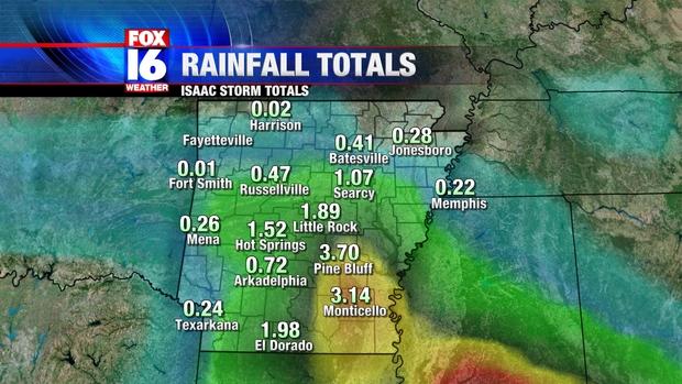
Isaac will likely be a slow mover after landfall, which brings us to our next issue, which is inland flooding. Heavy rains are likely to continue well after Isaac makes landfall. The current track takes Isaac into Eastern Arkansas by late this week.


The heaviest rain will be along and to the East of the center. If Isaac takes the track above, areas such as Jackson and Memphis would likely get some torrential rain. Should Isaac take a more Westerly route, Central Arkansas would wind up near or just East of the center, raising the potential for flooding rainfall. It is too early to call for any rainfall amounts given the questionable track, but amounts greater than 6" are likely along and just East of center.

Isaac's Sudden Shift

In a blink of an eye, Tropical Storm Isaac's fate has changed in a big way.

This afternoon the most talked about tropical storm is getting stronger.  An eye wall is being detected on radar while top winds are holding around 65 mph.  As it ventures past the Florida Keys today it is expected to hover over warm waters in the Gulf of Mexico.  With little wind shear in place, this ordinary cyclone is expected to blow up into a category one or two hurricane in matter of days.


We knew the storm would become better organized but the meteorology world wasn't quite prepare for the data we received today.  The future hurricane could move west...way out west.


(GFS model showing Isaac slamming Louisiana late this week)


Tropical models that once pegged Isaac to hit Pensacola, FL now are spread all over the place and have Louisiana in the mix for potential landfall spots.  So what happened?  Where did this radical change come from?

All tropical storms are dictated by the upper level winds from either low or high pressure.  In this case, a high pressure in the mid-level of the atmosphere was expected to break down and allow Isaac to move northward once it hit the gulf.  The latest information now shows that the high pressure will remain firm and steer Isaac more westerly.

When you put it all together, Arkansas could actually feel effects of Isaac after all.  Half of the global models out there show the remnants of Isaac curling toward Arkansas bringing flooding rains by Friday night.  On any other day that would be fantastic, but the fact that high school football kicks off at the same time could be a little problematic for folks.

Needless to say, don't write home Isaac just yet.  There could more twists and turns before we know exactly where it will end up.  Make sure to stay up to date on FOX 16 and look for more blog posts in the future.


Friday, August 24, 2012

Isaac Targets Gulf Coast

The meteorology world is buzzing with the latest data pouring in from Tropical Storm Isaac.

Today Isaac is a strong tropical storm with winds swirling around 60 mph.  Recon data shows the tropical disturbance is better organized and shows no signs of slowing down before heading for Hispaniola.  The only feature lacking with this disturbance is the storms near the core.


In the future, Isaac will continue to track northwest since there is a break down of an mid-level ridge in the Atlantic.  This northwest path will lead the tropical storm through high terrain over the weekend, thus it will not reach hurricane strength over the weekend.


Once the cyclone hurdles Cuba, the tropical storm will recompose itself and likely reach a category one or two hurricane before making landfall near the Alabama/Florida beach coast.  Right now, the forecast models show Isaac slamming into Pensacola, Fl and I agree with that assessment.

The only big question is what happens to Isaac after it reaches our U.S. coast.  Majority of the global models want to shove the left overs of Isaac to the east and miss Arkansas.  While a few outliers, namely the European model, are showing it bringing rain to eastern side of the Natural State.

I'll continue to monitor Isaac's progression and more updates on the blog and on the newscast.  Until then have a good weekend.
  

Tuesday, August 21, 2012

Tropics Awaken

After a seemly quiet tropical season, the Atlantic Ocean has given birth to a couple disturbances that bear watching in the next few weeks.


The first tropical cyclone that is on our watch list is labeled Tropical Depression Nine but in a matter of days it is expected to be a full-fledged tropical storm and possibly a hurricane.  The depression, soon to become "Isaac", is hanging out east of the Windward Islands and is continuing to feed warm, moist air into it's core.  With a hardly little wind shear in place and rich supply of warm waters, this storm is expected to rapidly intensify soon.  The National Hurricane Center is well aware of the situation and are sending reconnaissance planes to intercept the storm later this afternoon.


                      (GFS model showing a strong tropical storm or hurricane hitting Gainesville, FL one week from today.)
                         
This tropical disturbance wouldn't garner a lot of attention if it weren't for the fact that almost every single hurricane model shows it slamming into Florida early next week.  It's early to speculate that the Sunshine State would take a direct hit but the upper level flow does favor the storm racing toward our southeast border.  All in all, this storm needs to be monitor especially when you consider the Republican National Convection will down there the same week the storm could reach shore.


Another tropical wave we have on the back burner just formed by the Cape Verde Islands, over to the west of Africa.  Given the situation at hand, we'll worry about this storm complex later next week as it continues to turn over in the middle of the Atlantic.  As for now we'll keep most of the attention on the storm at hand in the Caribbean.  Until then make sure to stay with us for more tropical updates.


Saturday, August 11, 2012

Unseasonable Weather for August

Hands down, today was one of the best days we've had in over month. I know you're thinking this might not last long, well, actually, the weather looks to be even cooler by mid-August.

                                     (Upper level flow for this week and next weekend)

I guess the stars are aligning just right for Arkansas because our upper level flow will allow two cold fronts to rush into the state later this week.  Not only will the cold fronts bring us much needed rain chances, but the frontal boundaries will reinforce mild air from the North.

If the weather models are correct, which I believe they are, we could be looking at daytime highs only reaching the mid 80's by this same time next week.  How's that for a cool down in the summer?

One can only hope this weather pattern will stretch all the way through this month because lord knows we need it around this region.  Only time will tell if Mother Nature will be kinder to us late this summer.

Saturday, August 4, 2012

Ernesto Aims for Yucatan

While Arkansas endures the triple digits, more and more of my attention is being drawn to the Caribbean.

At this hour, Tropical Storm Ernesto is a fairly healthy tropical cyclone with winds swirling around 60 mph.  The tropical storm is drifting westward at a good clip and features decent structure.


As Ernesto continues to feed warm, rich moisture into his belly and enter a more favorable environment, it is expected to reach hurricane strength by Sunday.  Eventually the tropical storm will continue it's west-northwest path until it reaches the Yucatan Peninsula by the middle of the work week.


The million dollar question is where it will go after slamming the Yucatan.  Well, first let's look at modelling.  Majority of the global weather models suggest a west-northwest current will take Ernesto south of Texas and into Mexico.  While only a few dynamical hurricane models, like the GFDL and HWRF, are more radical in turning it straight for the Louisiana coast.  For now, I'll stick with the global models since they've been on track with Ernesto from the start and they have a good grasp on this system.  In other words, for now, I believe Ernesto will not be impacting Arkansas or the U.S.

We'll continue to monitor the latest data from Ernesto in the coming days. If there are any signs that will take a northward turn we'll certainly let you know about it.  Until then have a good weekend and be careful in this heat.


Wednesday, August 1, 2012

Less Intense Heat

Day after day, we've set record high temperatures and watch heat index values soar to dangerous levels.  It almost feels like there is no end to this oppressive heat wave.  Well, believe it or not, there could be a brief period where the heat won't be as intense.


This Sunday, the weather models are clear that an upper level trough will usher in a fairly strong cold front through the Ohio Valley.  At the very end of the boundary there will be enough energy to help bring in a few spotty storms through Arkansas.  Besides the needed rain, the best outcome out of this front will be the "cooler" weather.

Next week the weather models are hinting that highs may stay below 100°.  I know it's not a major cool down, but it beats having to rely on our air conditioner 24 hours a day.