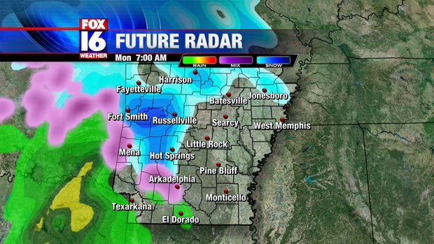
7 AM: Light snow begins across West Central Arkansas, just reaching Russellville and Hot Springs. Cloudy with a few spits of sleet possible further East including the Little Rock area. No significant travel problems at this time. This is our computer model projection for 7 AM Monday:
9 AM: Snow begins around the Little Rock Metro area as well as areas such as Conway, Sheridan and Heber Springs. Temperatures will be below freezing at the onset, so travel conditions will quickly become hazardous. Snow will transition to sleet and freezing rain roughly South of a line from Hot Springs to Sheridan to Pine Bluff.

1 PM: Mixed precipitation will reach Eastern Arkansas, with mostly rain Southeast Arkansas, and a mix of snow and sleet Northeast mainly North of I-40. As warmer air moves in just above the surface, snow will transition to a mixture of freezing rain, sleet and rain South of a line from Russellville to Conway to Beebe. A mix of of snow and ice pellets can be expected North of this line for much of North Central Arkansas. Travel will remain hazardous into the early afternoon except for Southern Arkansas, where temperatures will be well above freezing

5 PM: Temperatures will begin to warm above freezing across most of Central Arkansas, turning roads slushy and travel conditions begin to improve.
7 PM: Most remaining precipitation in the form of rain with temperatures a couple of degrees above freezing. A few spots of freezing rain may persist North. Travel conditions will continue to improve, but will remain dangerous in some spots.

Below are our forecast snowfall totals. This may change depend on the timing of the transition from snow to mixed precipitation. The sooner the transition occurs, the less snow will accumulate.

No comments:
Post a Comment