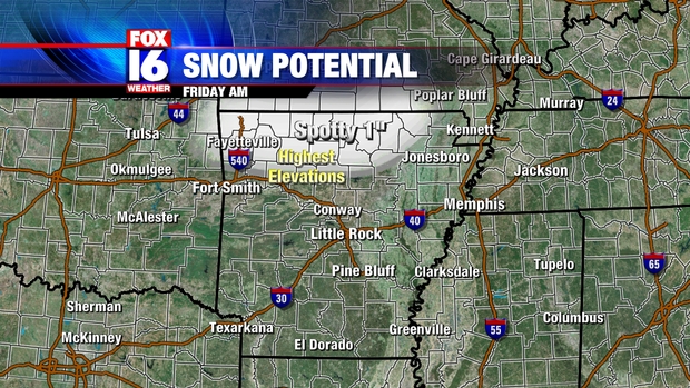
A disturbance moving across the State ahead of an approaching cold front will bring light rain to the area on Friday. Temperatures will be just cold enough across parts of Northern Arkansas to support some mix in with snow for a short time. Some minor accumulations are possible for the higher elevations, mainly above about 600 feet and North of a line from around Clinton to Heber Springs to Batesville. The map below shows where snow may mix with the rain
Showers will come to an end by early afternoon as the disturbance pushes East. An Arctic cold front will sweep through during the evening ushering in a blast of even colder air for the weekend. High temperatures on Friday will range from the mid to upper 40s for Central Arkansas to the upper 30s North. Skies will clear out Friday night behind the cold front with lows dropping into the mid to upper 20s.
No comments:
Post a Comment