
The storms may produce some locally heavy rainfall as the front slows down as it moves through Arkansas. A few storms may also be strong to severe, with warm & moist Gulf air ahead of the front.
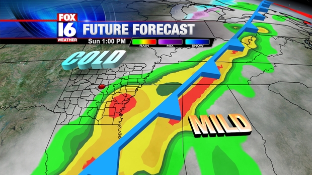
The front will move through Saturday night with colder air filtering in Sunday. Temperatures will drop through the 40s Sunday with some lingering showers behind the front. The forecast map for Sunday afternoon shows Arkansas on the cold side of the boundary with some lingering rain, especially for Eastern and Southeast Arkansas.
The front will stall Southeast of Arkansas by early Monday morning with a wave of low pressure moving up along the front. As moisture is thrown back into the cold air, temperatures may be just cold enough for some freezing rain over parts of Arkansas.

The specific timing of the wave of low pressure moving along the front is still very much in question with significant differences in computer model projections this far out. The Westward extend of the precipitation will also be key in determining where freezing rain is most likely. As the forecast confidence increases, we will be able to better determine the timing of the Wintry Weather and what parts of Arkansas would be most at risk. Right now, the highest chances for icing are for North Central Arkansas Monday night into early Tuesday. This preliminary forecast can change significantly over the next couple of days so stay tuned to the forecast.
No comments:
Post a Comment