Tuesday, October 18, 2011
Colder Air Not Far Away
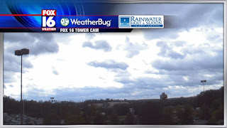
Mother Nature sure knows how to bring in a cold front. Today the scenery is far from what we saw yesterday. The sky is gloomy and dark. Meanwhile, our ground is riddled with puddles from earlier storms. On top of all that, temperatures are struggling just to stay in the 50's.
As a fellow northerner, this definitely reminds me of fall up in the Great Lakes. Of course, we're no where near Detroit or Michigan for that matter so this weather pattern won't be sticking around for very long.
Whether you hate it or love it, the weather pattern will modify as we go into latter half of your work week. We'll get plenty of sunshine in here with temperatures moving up to the 60's and 70's.
(One weather model showing storms and cold front for next week Wed.)
(GFS model showing high's for next week Thursday only in the 40's...yikes)
Looking down the road, I couldn't help but notice another strong cold front coming down the pike. All of the long term models agree that another push of cold air is in the works by the middle of next week. If I had to guess at this point, I would say this air is colder than the one we're going through today. Bottom line, we're looking at high's in the 50's potentially the 40's in some spots.
Subscribe to:
Post Comments (Atom)


No comments:
Post a Comment